
Egypt Through The Stereoscope
A Journey Through The Land Of The Pharaohs
by James Henry Breasted | 1908 | 103,705 words
Examines how stereographs were used as a means of virtual travel. Focuses on James Henry Breasted's "Egypt through the Stereoscope" (1905, 1908). Provides context for resources in the Travelers in the Middle East Archive (TIMEA). Part 3 of a 4 part course called "History through the Stereoscope."...
Position 73 - Down The Nile (northeast) Across The Western Cliffs Of Thebes
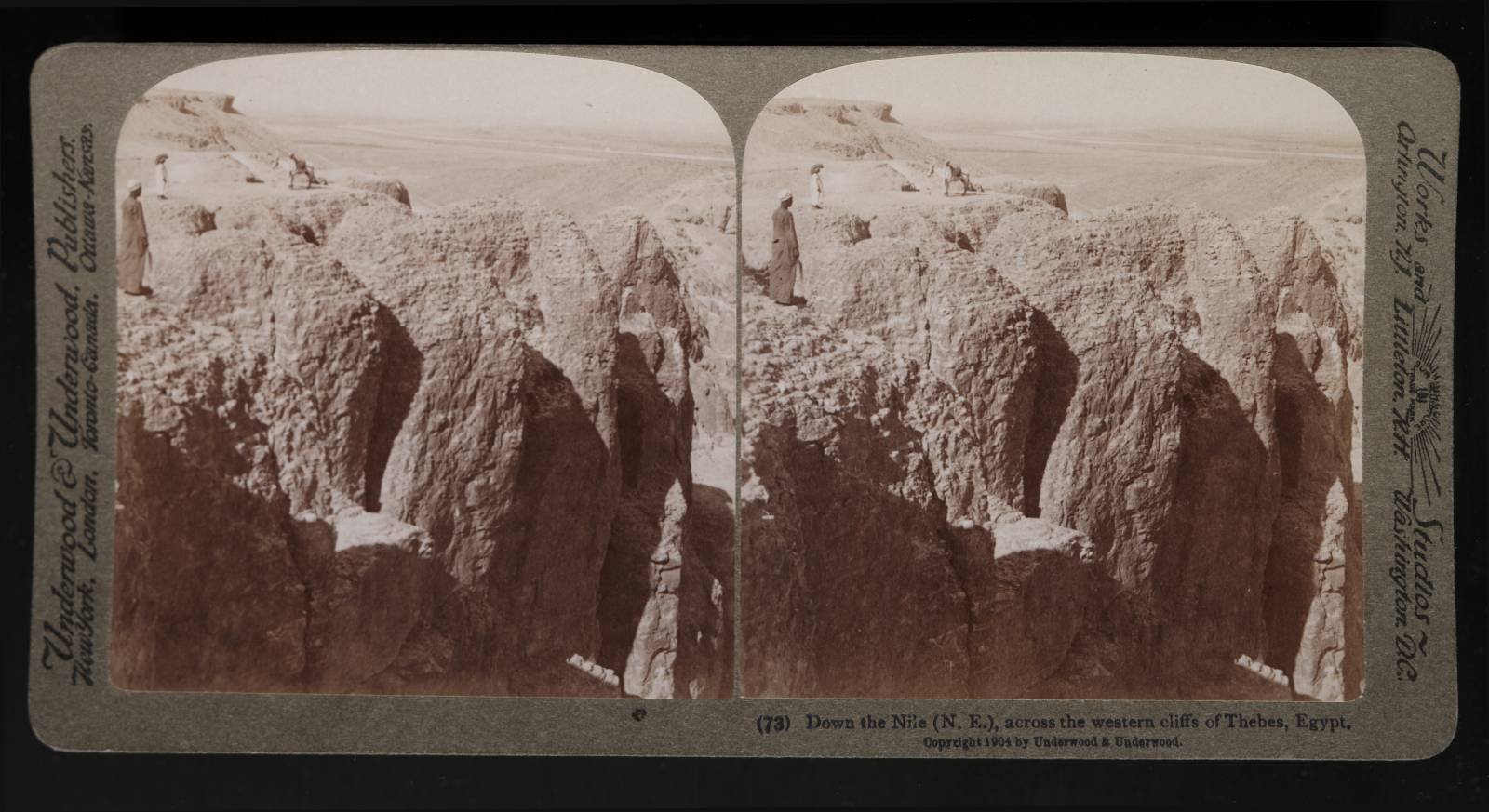 Here is the rugged crest of the rocks which flank the temple of Der el-Bahri, as we saw them from below when we visited the temple (Position 70). We have now turned to the left from our former direction, and whereas we then looked directly across the river, we are now looking down the river (Maps 8 and 3). On our right, but out of our field of vision is Karnak, on the left the desert, and behind us the upper river. Far down the valley, making a wide sweep westward, and in the distance turning again eastward till it is lost on the horizon, is the river, which cut out this remarkable valley and made of it a habitable land.
You can see this curve better on the large Map 3. So it winds on past Cairo, nearly five hundred miles to the sea. Here sailed forth the fleets of the Theban princes against those of Assiut, back in the days when the supremacy of the north or the south depended upon the long civil conflict, till by the 22nd century B. C. Thebes won, and established the 11th Dynasty in the south to succeed the 10th in the north.
Who would have supposed that this comparatively narrow stream should be the sole source of fertility in this valley? As we see the river here it is but 2,000 feet wide, and at its widest it is but 3,300, while at its narrowest point, at Silsileh, it is but a little over 1,100 feet. These cliffs before us, and all that we have thus far seen, are of limestone, but as we proceed up the river and pass Edfu, which is sixty-eight miles from the first cataract, we shall find them changing to sand-stone, which continues throughout Nubia.
With such excellent building material awaiting him on both sides of his narrow valley, it was, of course, a foregone conclusion that the Egyptian must become a master of masonry, and thus it is, that we find the earliest known stone masonry in this valley, while in Babylonia, where there is no stone to be had, the people only learned brick masonry, and the art of cutting and laying stone was almost unknown.
Thus this river, with its requirements for irrigation devices of many kinds, and the cliffs, with their unrivaled building materials, made Egypt the mother of the mechanical arts, from which the later civilization of the Mediterranean basin largely profited, and bequeathed them to us of this modern world. As the Nile is the real maker of these cliffs, we see what a benefactor to all mankind this ancient river is and has been.
But now we must turn about to the left, with our right side toward our present outlook and our backs to Karnak, and we shall see where the kings were laid. This next outlook is given in the upper middle portion of Map 9. That particular section to be looked over is also given on a larger scale in the upper left-hand corner of Map 9.